
Which Waze?
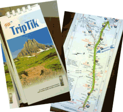 When was the last time you looked at a paper map to get somewhere? A long time ago, I know. I remember ordering the AAA TripTiks not so long ago – plotting the route we would take while on the road to a vacation. Ok, so now I feel old.
I also remember when I got my first navigational system, a Garmin box that had a suction cup to attach to the windshield. That device was life changing – I found new ways to get around the town, and I distinctly remember feeling like this new technology was finally addressing my navigationally-challenged self.
How did this happen?
What you might not know is that these systems, along with Google Maps and Waze, built-in car navigational systems and other mapping applications on your phone – are some of the first commercial implementations of Open Data. Yep, it’s true. (And yes, I’ve written about Open Data before.)
The data used for these systems is GPS – Global Positioning System data. Read More…