
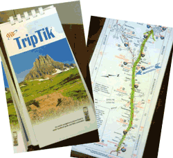
 When was the last time you looked at a paper map to get somewhere? A long time ago, I know. I remember ordering the AAA TripTiks not so long ago – plotting the route we would take while on the road to a vacation. Ok, so now I feel old.
I also remember when I got my first navigational system, a Garmin box that had a suction cup to attach to the windshield. That device was life changing – I found new ways to get around the town, and I distinctly remember feeling like this new technology was finally addressing my navigationally-challenged self.
How did this happen?
What you might not know is that these systems, along with Google Maps and Waze, built-in car navigational systems and other mapping applications on your phone – are some of the first commercial implementations of Open Data. Yep, it’s true. (And yes, I’ve written about Open Data before.)
The data used for these systems is GPS – Global Positioning System data.
This information comes from a space-based satellite navigation system that was built and maintained by the Department of Defense (DoD) in 1978, and is now freely available to anyone in the world with a GPS receiver. The availability of this data has had a huge impact on business and society in general – and has changed the way we all interact with the world around us. It’s used in every sector of our lives – from agriculture, construction, transportation and has allowed new productivity and efficiency implementations across the board. And, whole businesses have been created using this technology. For instance, farmers use GPS to help with crop planning – and yes, GPS is what helps those beautiful corn mazes get built. GPS will get your emergency vehicles to you more quickly in an accident, and ensure that your cruise ship gets you to the next port.

Learn more and see the BIG poster at: How GPS Works (gps.gov)
GPS Social Mapping
GPS is so omnipresent, that we don’t even think about it anymore. We tell Siri to get us to a location, and our phone instantly shows us a map, and we indicate if we are walking, biking or driving – to ensure we get the safest route based on our mode of transportation.
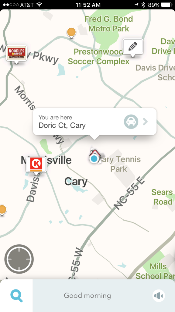
My house on Waze
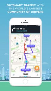
But, here’s the cool part. New GPS products are allowing our mapping tools to be reactive to dynamic changes in the transportation system around us. For instance, Waze is a free mobile app for your phone, and it’s what we call a Social GPS tool. It taps into the information of “Wazers” – that is, folks that use Waze and have allowed the app to share their transportation information, such as slow-down information directly from the drivers, themselves. By combining this information with data from other Wazers – the goal is to take this combined information from other drivers and use it to improve everyone’s commute.
What does that mean? Well, by allowing Waze to see where you are, how fast you are going, and allowing you to contribute information such as slow downs, hazards and accidents, Waze creates a community-based map that provides real-world information about the status of traffic. All of your data is anonymized, so individual data cannot be shared.
Here’s an example. I was driving to a meeting in downtown Raleigh a few months ago, and I was using Waze directions to get there. All of the sudden, Waze started directing me to get off of I-40 and to take the backroads that would lead me downtown. Little did I know it, but a huge back up was happening about 3 miles ahead due to an accident, and it was being detected by Waze. The app was proactively re-routing me based on that real-time traffic and road information being provided by Wazer’s data.
There are more than 50 million monthly active Waze users today – whether they are using it “actively” – meaning interacting with the app, or “passively” just allowing the app to contribute their speed, congestion and routing insights to the app. They also have map editors (volunteers) that update maps and verify local edits to ensure accuracy.
I’m from the Gov’ment – I’m here to help
But, and here’s the cool thing, Waze also has a “Connected Citizens Program” that now allows municipalities to provide information to the app, giving users a look at real-time road activity, construction and road closure data AS IT OCCURS, so that you can be re-routed BEFORE you’re sitting in traffic. This 2-way communication, or data exchange, allows transportation systems and cities to get real-time information that can help with faster emergency response time, and to help Waze users get around road closures and other incidents quickly. Over time, as Cary implements a phased rollout plan, Waze will provide real-time anonymous incident and slow-down information while the Town of Cary provides real-time and advance information on construction, crash and road closure data. More than 100 partners such as cities, state and country government agencies – as well as nonprofits and first responders are using this tool to help ease road congestion and make an impact by getting the right information to the right people, at the right time.
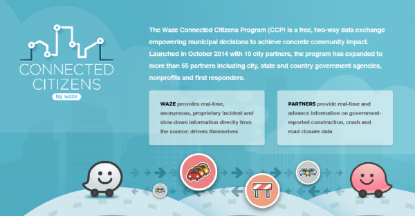
WAZE Connected Citizen Program
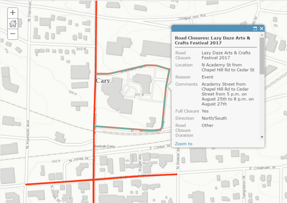
So how does this work on the ground? Well, you know that road that is planned to be closed by your house soon? Well, now we have a way for the Town of Cary to send that road closure information to Waze, so that you and other drivers will be re-directed away from that closure, and not be impacted and stuck in traffic. We do that proactively, looking at our upcoming closure data and planned events, and then the Town provides that relevant information including road name, reason for closure, date and time of closure, and GPS coordinates to Waze.
And this isn’t just for road construction, either – this capability is especially helpful for planned events. For instance, coming up soon is a great event called the Tobacco Road Marathon. This marathon and half-marathon is in Cary, on March 19th, and it starts at USA Baseball in Cary. There will be a number of roads closed to traffic during the race – and it might be frustrating for some residents to navigate – but never fear! If you use Waze, just know that the Town will be sending road closure information to the app, and you will be rerouted around those closed streets. Cool, huh?
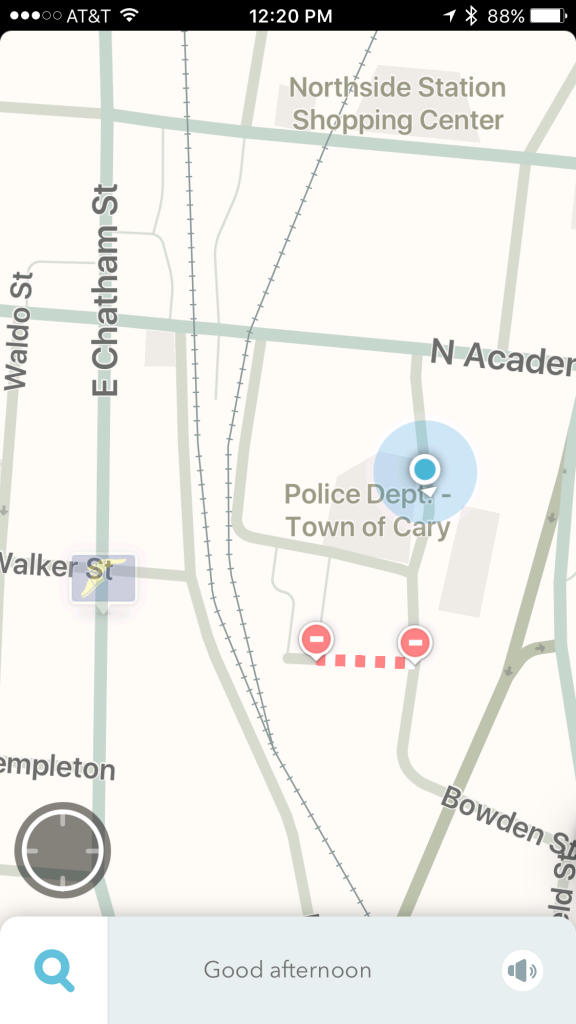
I went in to get a peek at how this works – and wow, this is great. The IT Cary Innovation team (that’s my new name for these awesome folks) closed off a small street behind Town Hall – Cary Street – and then sent that information to Waze.
 Immediately, the application updated the map, and showed the closed road. Of course, this can be planned way in advance, as well.
Close Cary Street
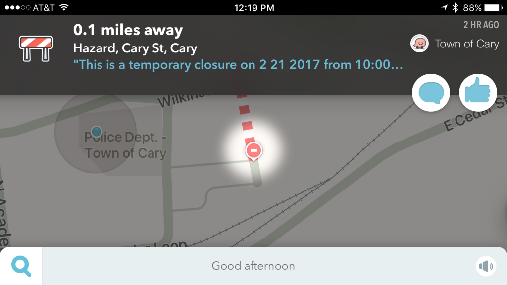
Also, while “navigating” it would also re-route me, away from that closure. (Of course, there are lots of processes and security behind the scenes, to make sure that only the RIGHT people can close a road and send that information to Waze.)
Why are we doing this?
There are several reasons.
– Leveraging this technology solution will improve our citizen’s quality of life by saving folks that use this app, time and gas money on their daily commute
- – Utilizing Waze data will help to improve city planning, inform our infrastructure decisions, and increase efficiency of day-to-day operations
This tool has done great things for many of the cities leveraging its capabilities; Boston has seen a measurable reduction in key city centers, emergency response times have been reduced, and it’s helped facilities infrastructure planning in Rio de Janeiro.
Being able to save you time on your commute, reduce traffic, and of course, that means reducing pollution, is important to you and our community. The more WAYS (ha, see what I did there?) we can do that, the better it is for everyone.
2 Responses to Which Waze?